Home
  • About
    • What Is Resilience?
    • Who We Are
  • Building Resilience
    • Climate
    • Governance
    • Economic
    • Social
  • Regions & Countries
    • Africa
    • Asia
    • Latin America & the Caribbean
  • Events
    • Upcoming Events
    • Past Events
  • Resources
    • Training
    • Tools & Guidance
    • Reports
    • Monthly Newsletter

Breadcrumb

  1. Home
  2. Resources
  3. Tools & Guidance
Tools & Guidance

Surface Water Mapping Tool

Deltares, Technical University Delft, SERVIR-Mekong, eartH2Observe, Google, ADPC, Stockholm Environment Institute, Spatial Informatics Group, Asian Disaster Preparedness Center

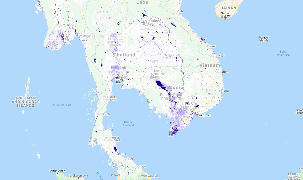
The Surface Water Mapping Tool documents the dynamics of seasonal flooding cycles on the Mekong River to better understand some of the impacts of dams. 

Map of Southeast Asia

More Info

The Surface Water Mapping Tool was initially developed to document the historical dynamics of seasonal flooding cycles on the Mekong River in order to better understand some of the likely impacts of completed and proposed dams. This tool can also be used to assess flood risk for disaster preparedness and identify areas of permanent water, which is valuable in the context of severe drought response. This tool has numerous other water resources management applications.

Surface water distribution changes over space and time. These patterns can provide insight into ecological structure and function, patterns of flooding and flood risk, and the impacts of infrastructure and climate change on landscapes and hydrological systems. However, such patterns have been difficult to track and measure over large areas and longer time spans. With increased access to large volumes of remotely sensed data and innovative techniques for optimizing the processing and interpretation of those data, these measurements are now more accessible than ever before. The Surface Water Mapping tool leverages the extensive archive of Landsat data in the Google Earth Engine archive and Google’s cloud processing power to quickly calculate past patterns of surface water extent from multiple layers of Landsat imagery. The tool consists of a Google Earth Engine application and a user friendly web interface which allows the user to specify the period evaluated and other calculation parameters that are then executed in a cloud service. Results are displayed on screen and can be downloaded for specified areas.

Launch the Surface Water Mapping Tool here.


Tags:

Climate Change
Water
Social Protection
Natural Resource Management
Return to top
USIAD Logo USIAD Logo

Explore USAID’s LINKS sites for learning and knowledge sharing

Agrilinks Logo
Agrilinks Logo

Achieving agriculture-led food security

BiodiversityLinks logo

Advancing biodiversity conservation

ClimateLinks logo
ClimateLinks logo

Improving climate change and development programming

EducationLinks logo
EducationLinks logo

Creating successful and effective education programs

GlobalWaters logo
GlobalWaters logo

Solving global water and sanitation challenges

LandLinks logo
LandLinks logo

Strengthening land tenure and property rights

LearningLab logo
LearningLab Logo

Maximizing development outcomes

MarketLinks logo
MarketLinks logo

Sharing market-based solutions for development

ResilienceLinks logo

Helping communities withstand crisis and thrive

UrbanLinks logo
UrbanLinks logo

Supporting sustainable urban development

  • Accessibility
  • Privacy Policy
  • Terms of Use

© 2023 Resilience Links

The information provided on this website is not official U.S. government information and does not represent the views or positions of the U.S. Agency for International Development or the U.S. Government. All rights reserved.

  • Twitter Twitter
  • LinkedIn LinkedIn

We use cookies on our website to evaluate site performance and improve your experience. Click Accept if you agree to the use of these cookies, or More Information to learn about how we manage information on our site.